This page last updated 2025-10-27.
UPDATES: (As of October 27, 2025)
Share Feedback
Subscribe to our Newsletter
Subscribe to Muni Planning News
Changes to the Proposal
Key Links
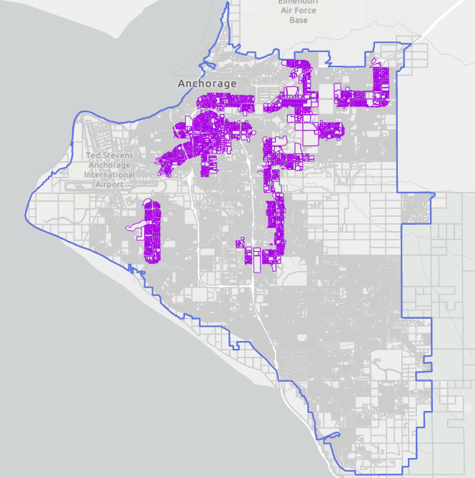
Original 2040 Transit-Supportive Corridors as published in the 2040 Land Use Plan
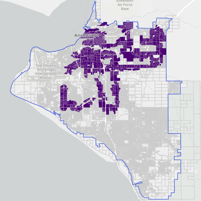
| Original TSDO proposed in July 2025
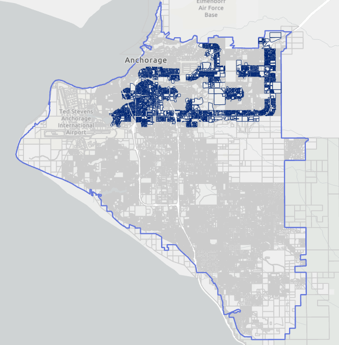
| TSDO Version 5
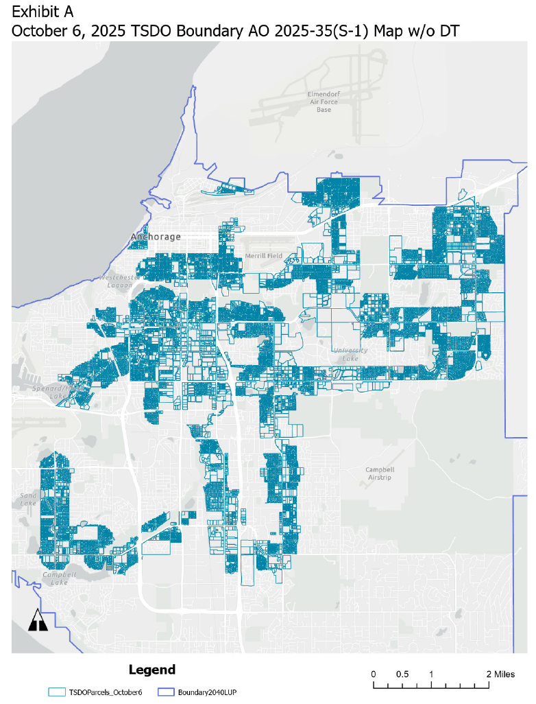
| TSDO Version 6
|
| 
| 
| 
|
Looking for more information? Refer to our Data and Information Library Page
Public Outreach by the Planning Department
(please note the sponsors may have conducted additional outreach)
-
Transit Supportive Development Overlay Meeting at the Anchorage Lutheran Church on N Street. 7:00pm-9:00pm on July 7, 2025
-
Planning and Zoning Commission work session on TSDO 5:30pm-6:30pm on July 14, 2025.
-
Planning and Zoning Commission regular meeting on PZC case 2025-0030 and PZC case 2025-0034.
- AMATS Community Advisory Committee Meeting online. 5:00pm-7:00pm on July 24, 2025.
- Anchorage Homebuilders Association Lunch and Learn: August 1, 2025
- TSDO Collaborative Conversation #1: August 4, 2025
- TSDO Collaborative Conversation #2: August 18, 2025
- Rogers Park CC presentation:
 Rogers Park CC presentation 2025-08-25 TSDO
- FCC Local Lens Presentation: September 2, 2025 2025-09-02 TSDO FCC Local Lens
- Downtown Community Council: September 3, 2025
- University Area Community Council: September 3, 2025
- Turnagain Community Council: September 4, 2025
- North Star Community Council: September 10, 2025
- Meeting with Mountain View Community Council leadership on September 11, 2025.
- Airport Heights Community Council: September 18, 2025
- Turnagain Community Council Land Use Committee: September 22, 2025
- Muldoon Transit Center Open House: September 24, 2025
- Special meeting with members of Rogers Park Community Council, Turnagain Community Council, YWCA, and Anchorage Housing Club: September 30, 2025
- University Area Community Council: October 1, 2025
- AMATS Technical Advisory Committee: October 2, 2025
- Planning & Zoning Commission Meeting: October 6, 2025
- North Star Community Council: October 8, 2025
Request a staff presentation at your Commmunity Council or Community Group