The WiRe Partnership
The Wildfire Division is partnering with the Wildfire Research Center (WiRē), a nonprofit organization, to bring a data driven approach to wildfire risk reduction in our community. After the organization conducted a successful project with the Kenai Peninsula Borough, we are excited to bring this effort to Anchorage.
WiRē works with communities to better understand wildfire risk by combining parcel level observations with community input. Their approach helps agencies prioritize resources, strengthen outreach, and support informed decisions about wildfire adaptation. You can learn more about WiRē on their website: https://wildfireresearchcenter.org/
Where This Is Happening
The study area for the WiRē project was selected
using data and priorities identified in the Municipality of Anchorage Community
Wildfire Protection Plan (CWPP), completed December 2025. The CWPP served as
the foundational dataset and strategic springboard for parcel-level
prioritization, particularly through its Suppression Planning Unit (SPU)
wildfire hazard ratings and associated risk analyses. View the CWPP map here.
Highest Hazard SPUs Prioritized
SPUs rated Extreme wildfire hazard were evaluated first for inclusion. All SPUs rated Extreme were included, with two exclusions:
- Rainbow: Omitted due to its small sample size, which would limit the value of assessment results.
- Stuckagain: Not prioritized due to strong existing collaboration with the Wildfire Division in wildfire mitigation and education.
Eagle River / Hiland Area Considerations
The Hiland SPU was added to ensure representation on the opposite side of the Eagle River valley. This area is characterized by constrained evacuation dynamics and some similarities with other SPUs rated as Extreme.
Only a portion of Lower Eagle River (Extreme) was included. A boundary was drawn to capture the transitional WUI while excluding more urbanized zones to allow for sampling across developinment types while maintaining fiscal discipline.
Inclusion of Girdwood
Girdwood represents a unique alpine and coastal interface within the Municipality, with wildfire dynamics that differ meaningfully from other regions. Including Girdwood provides an opportunity to ground future outreach and mitigation planning in localized parcel-level data and community member input. This inclusion ensures the dataset reflects the full range of wildfire environments present within the Municipality of Anchorage.
Municipal Geographic Representation
While hazard rating drove primary selection, a secondary goal was to ensure the assessment captured a meaningful cross-section of wildfire risk across the Municipality of Anchorage.
The selected study areas collectively:
- Span multiple geographic regions (Northern Communities, Anchorage Bowl, and Southern Communities)
- Embody varied fuel models and microclimates
- Represent communities at different stages of wildfire risk awareness and planning
This distribution ensures the resulting data can inform future CWPP updates, targeted outreach strategies, and prioritization of fuels mitigation projects at a municipal scale.
What to Expect
This project will roll out in three phases beginning in May:
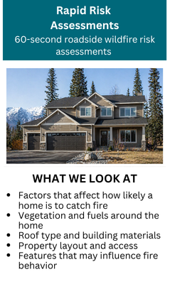
Phase 1: Rapid Assessments
Trained personnel will conduct quick, curbside wildfire risk assesments. These are visual, from the road only, and are different from in depth Firewise assessments, though some of the same general factors are considered.
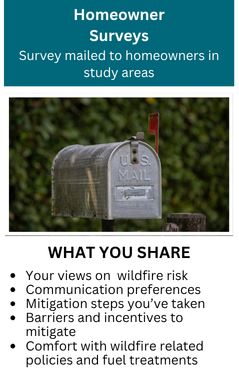
Phase 2: Community Survey
Following the assessments, surveys will be mailed to property owners. This is your opportunity to share input on wildfire concerns, risk perception, mitigation preferences, and community needs.
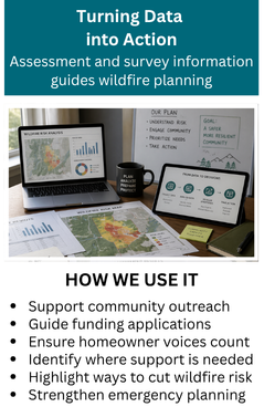
Phase 3: Data Integration
Assessment data and community feedback will be combined to create a clearer picture of wildfire risk across Anchorage. This information will help guide outreach, engagement, grant funding, and emergency planning efforts.